
My writeup on UIU CTF 2024 on the challs solved by my team ‘Bits & Pieces’, it was quite tough CTF but I got to learn a lot from it!
OSINT:
Night
That was quite a pretty night view, can you find where I took it? Flag format:
uiuctf{street name, city name} Example: uiuctf{East Green Street, Champaign}
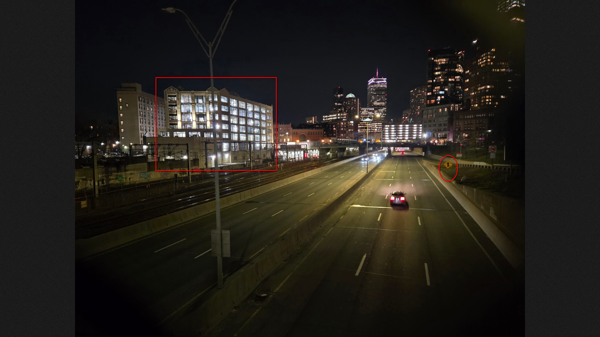
File: chal.jpg
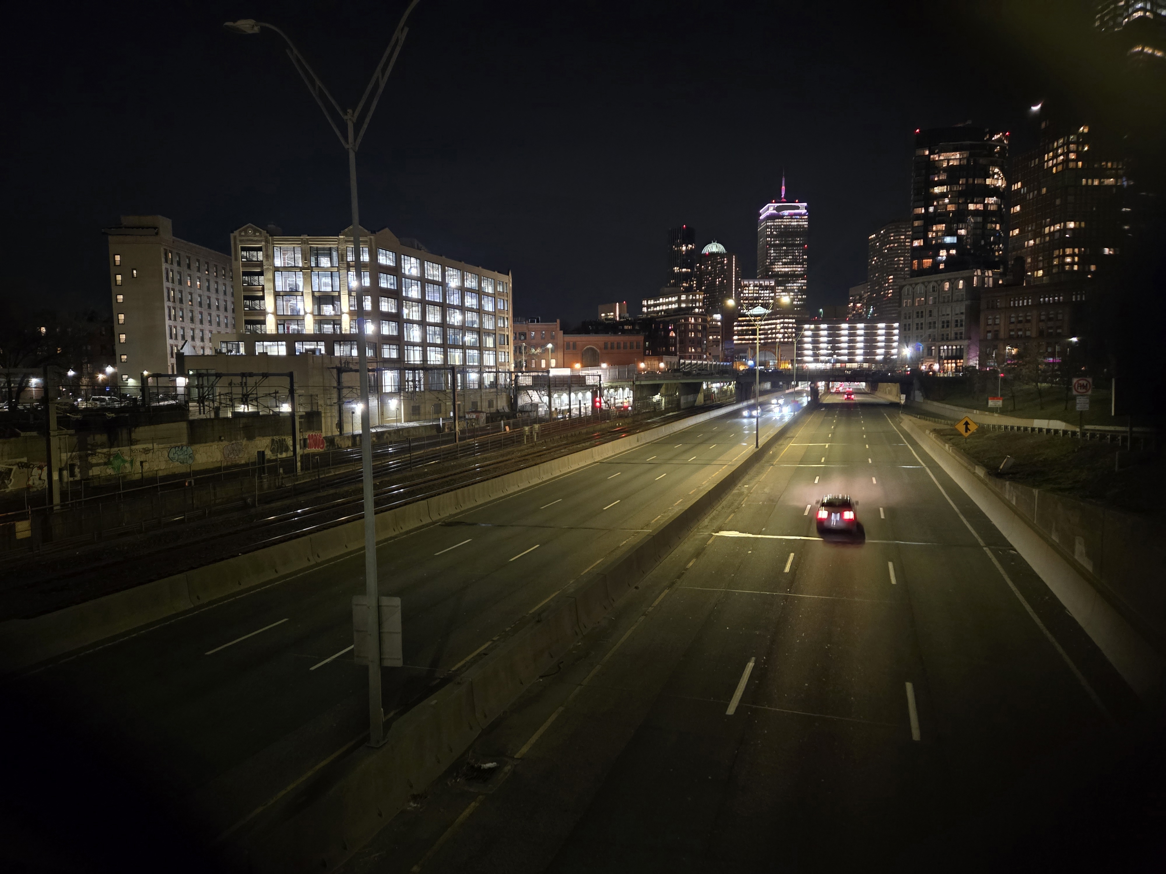
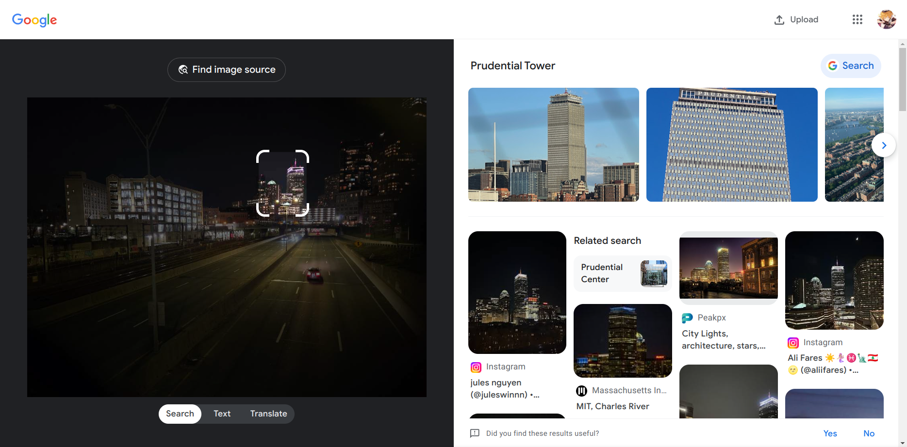
For this given image, I need to find it’s street and city name. So to start off, I hop on the google image search and try to find some clues.
We can clearly find that this is the Prudential Tower in Boston.
Next, there’s two key things to notice in the image that is, the “dome-like building” just adjacent to Prudential Tower and the underway.
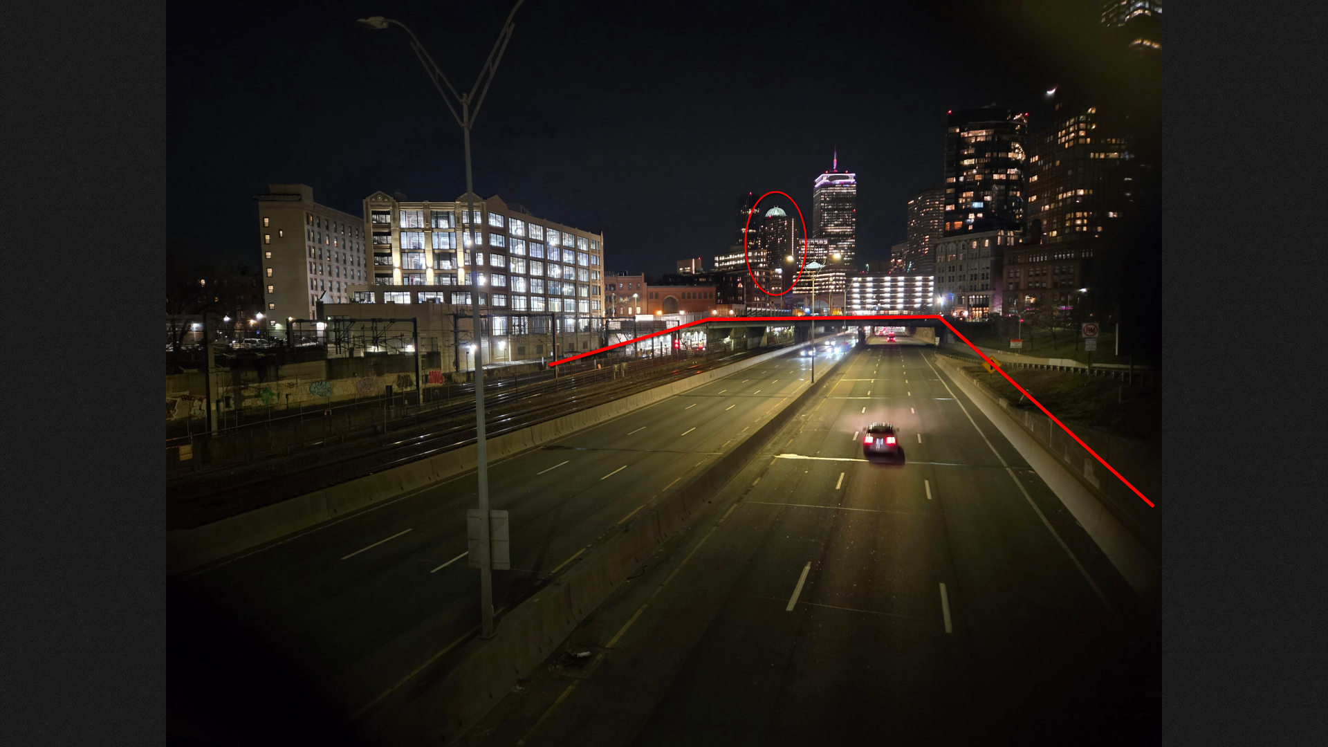
Opening Google Earth to preview this area, there’s just this directions, where you can find the buildings aligned in this specific way.
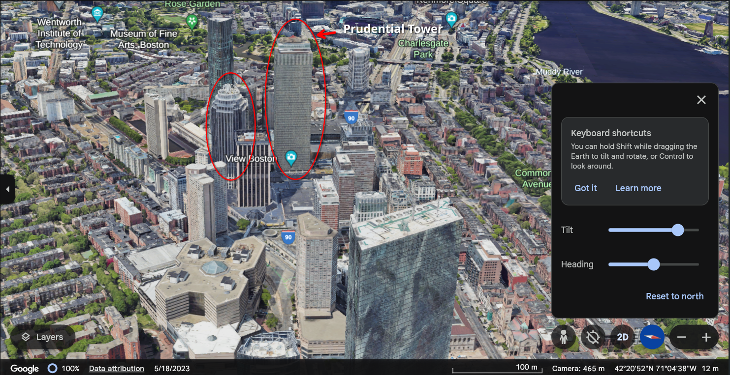
Here, you can see it’s the I90 Road we need to follow.
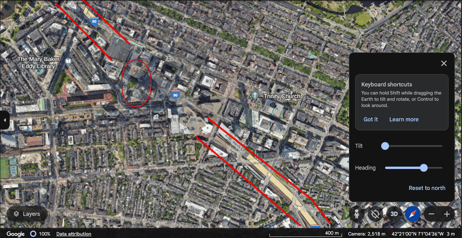
For confirming the specific location, you can notice in the image, that there’s sign board and the road merges here, that means- yes! it’s an intersection. Now it’s really easy to narrow down the position by looking for intersection where a glass building is present as well.
Searching a bit along the road, I found the location
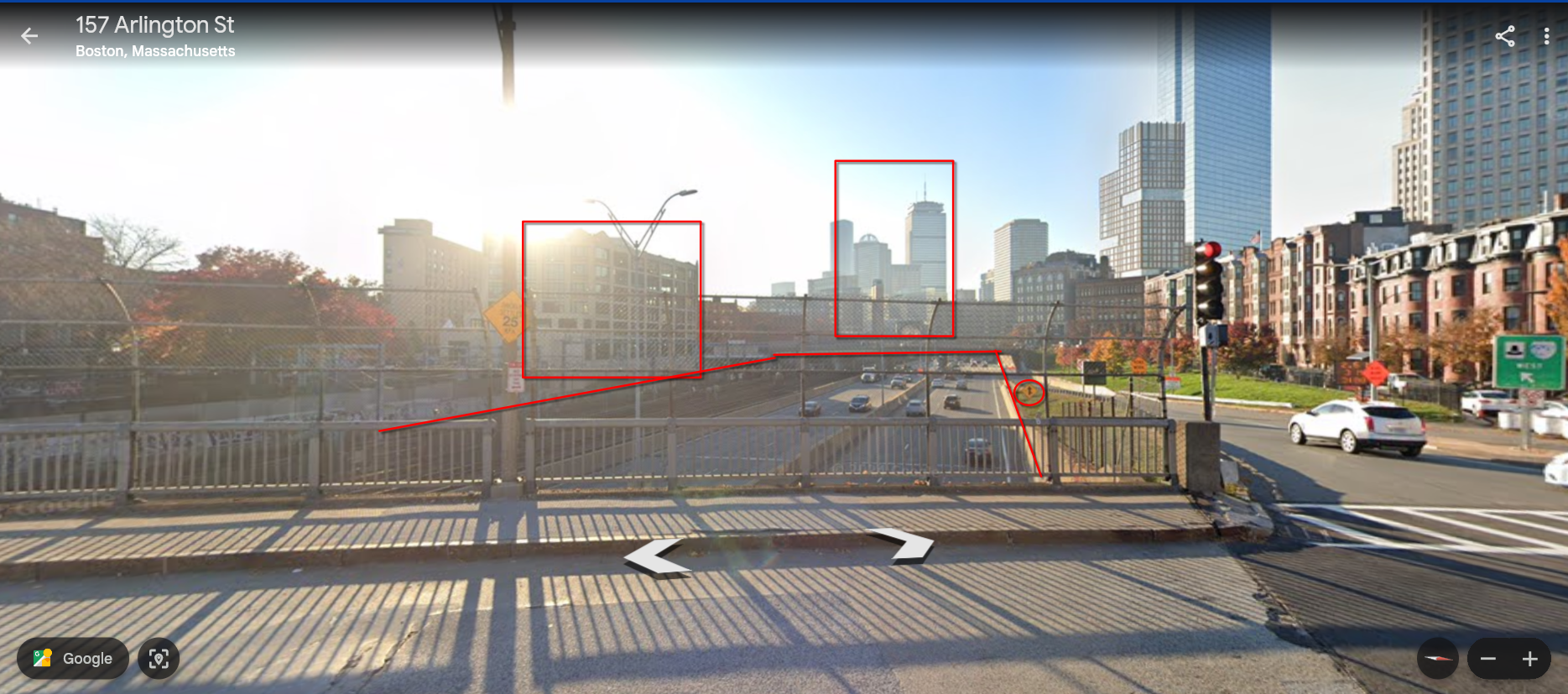
So there you go, its 157 Arlington Street in Boston.
Flag: uiuctf{Arlington Street, Boston}
Chunky Boi
Now that’s a BIG plane! I wonder where it is. Flag format:
uiuctf{plane type, coordinates of the aircraft} Example: uiuctf{Airbus A380-800, 40.036, -88.264}
For coordinates, just omit the digits, do not round up. Precision is the same as the one in the example. The aircraft name is the same as Wikipedia page title. You can extract enough information from this image to answer this. You DO NOT need to register any accounts, all the information is public.
File: chal.jpg
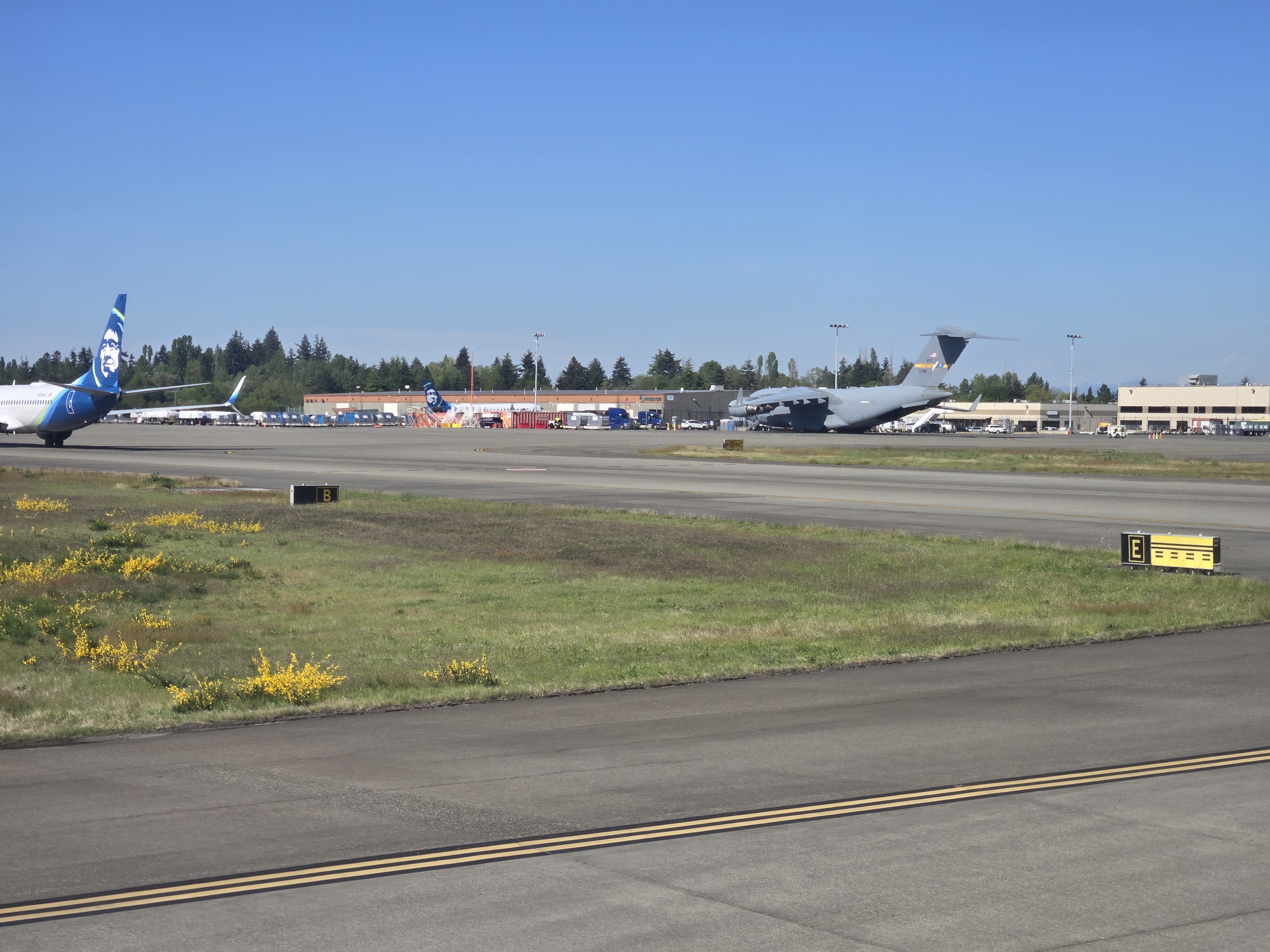
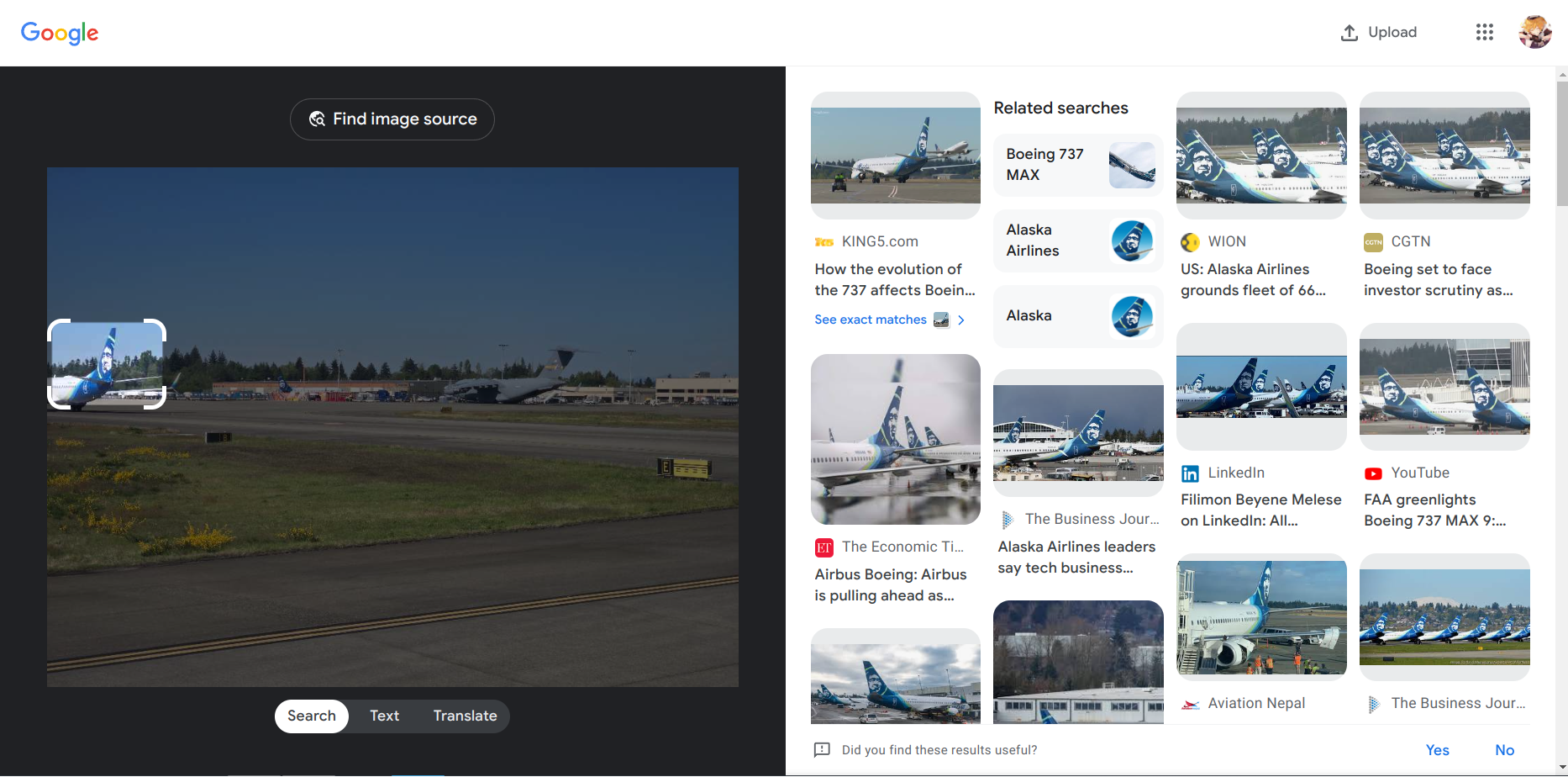
In the image, It seems like the image is captured near the runway of some airport. Vroom to google image search and we find that its Boeing airplane of the Alaska Airlines.
Now looking for the other aircraft
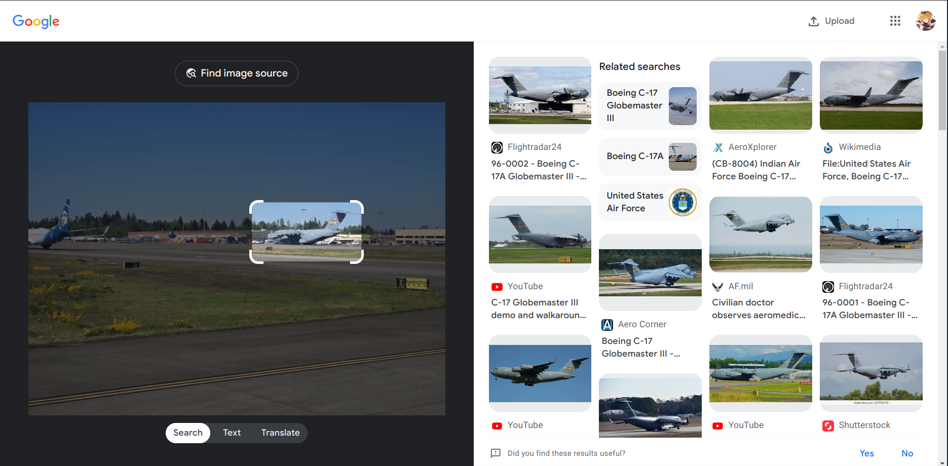
It’s pretty obvious that it’s the Boeing C-17 Globemaster III
Searching up on Google Earth for the Alaska Airlines, we can find this located in Seattle, Washington.
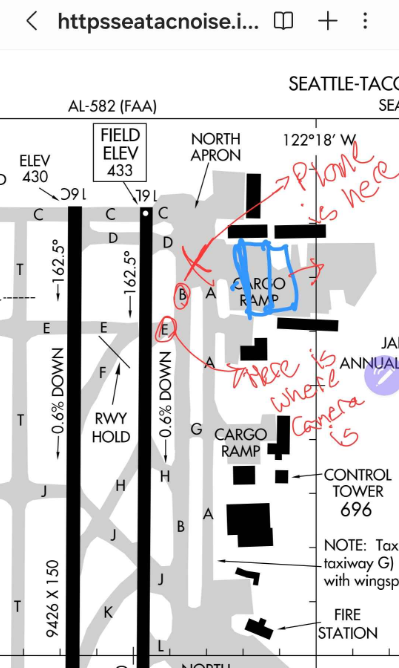
I was roaming around the whole area but nothing really helped, I checked almost all the locations which were present in the google earth view but it’s no luck. Here my teammate @Cha0s came in clutch, who found this document in the government website.
We mapped out where the location would be and came up with this.
Immediately went to look at the google earth view aound that location, and bingo!
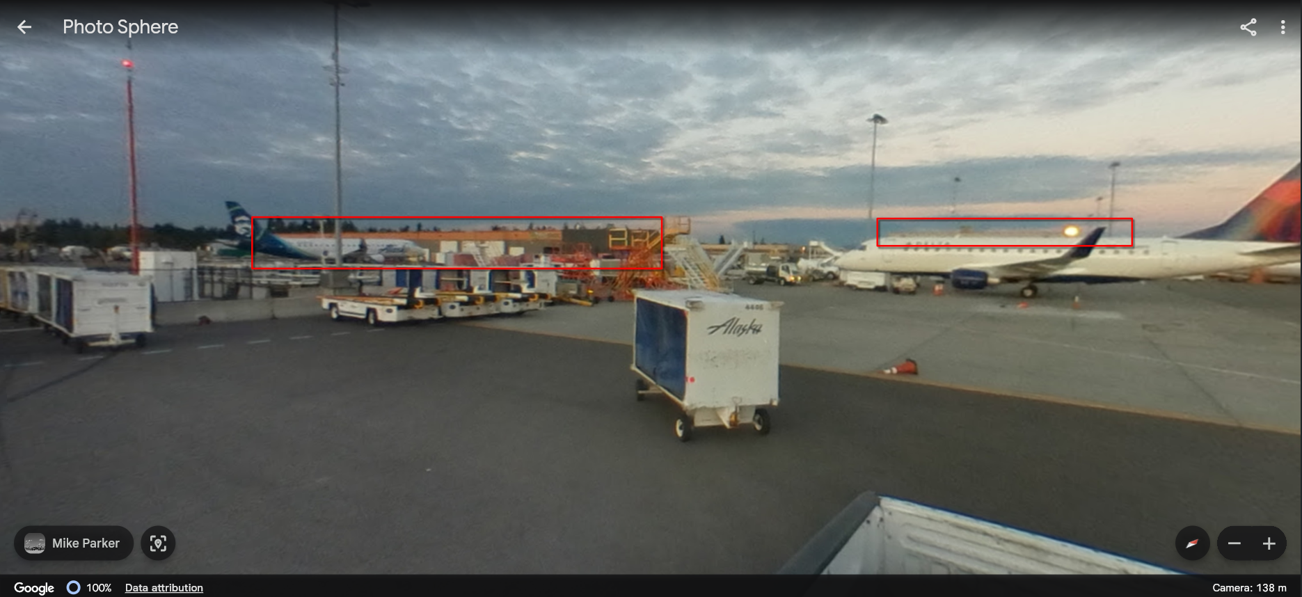
You can see the how this place matches the given image, marked in the red.
The coordinates of this location are 47.4627762,-122.3041687
So there you go!
Flag: uiuctf{Boeing C-17 Globemaster III, 47.462, -122.303}
New Dallas
Super wide roads with trains… Is this the new Dallas? Flag format:
uiuctf{coordinates of intersection between the rail and the road} Example: uiuctf{41.847, -87.626}
File: chal.jpg
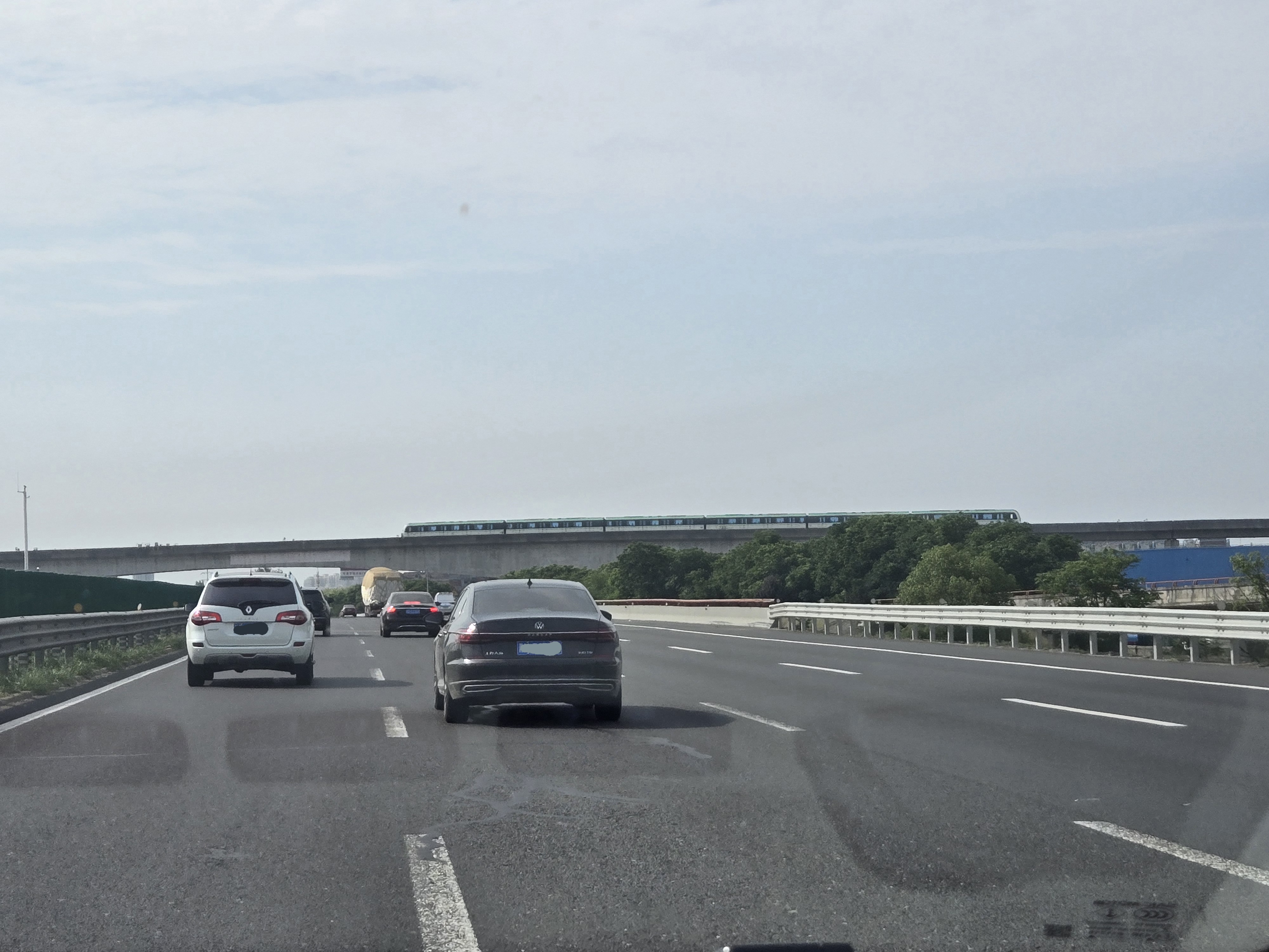
It seems like the picture is taken from a dashcam on a highway. Unlike previous 2 challenges, for this one there are not buildings or planes for easy to look for entities.
based on what’s left is New Dallas, cars and train. Making good use of it, firstly I searched for metro in New Dallas but I wasn’t able to get anything useful, Then I searched up on GeoSpy AI
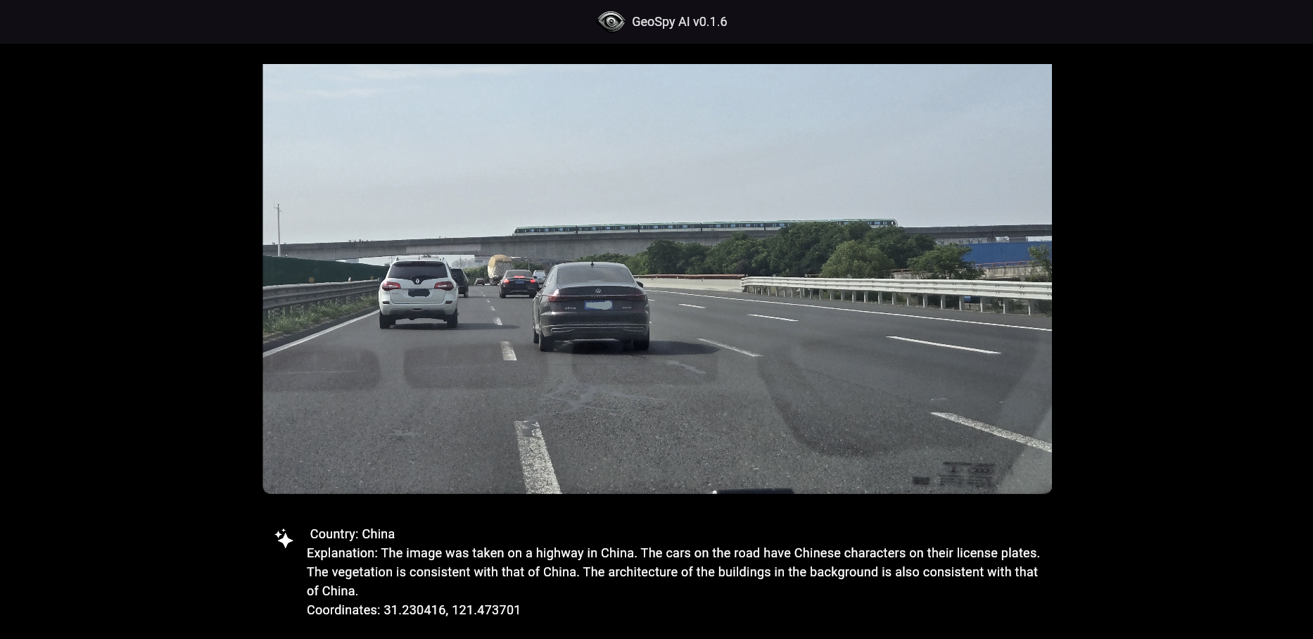
Well well, seems like this is a place in China, and NOT Texas 💀
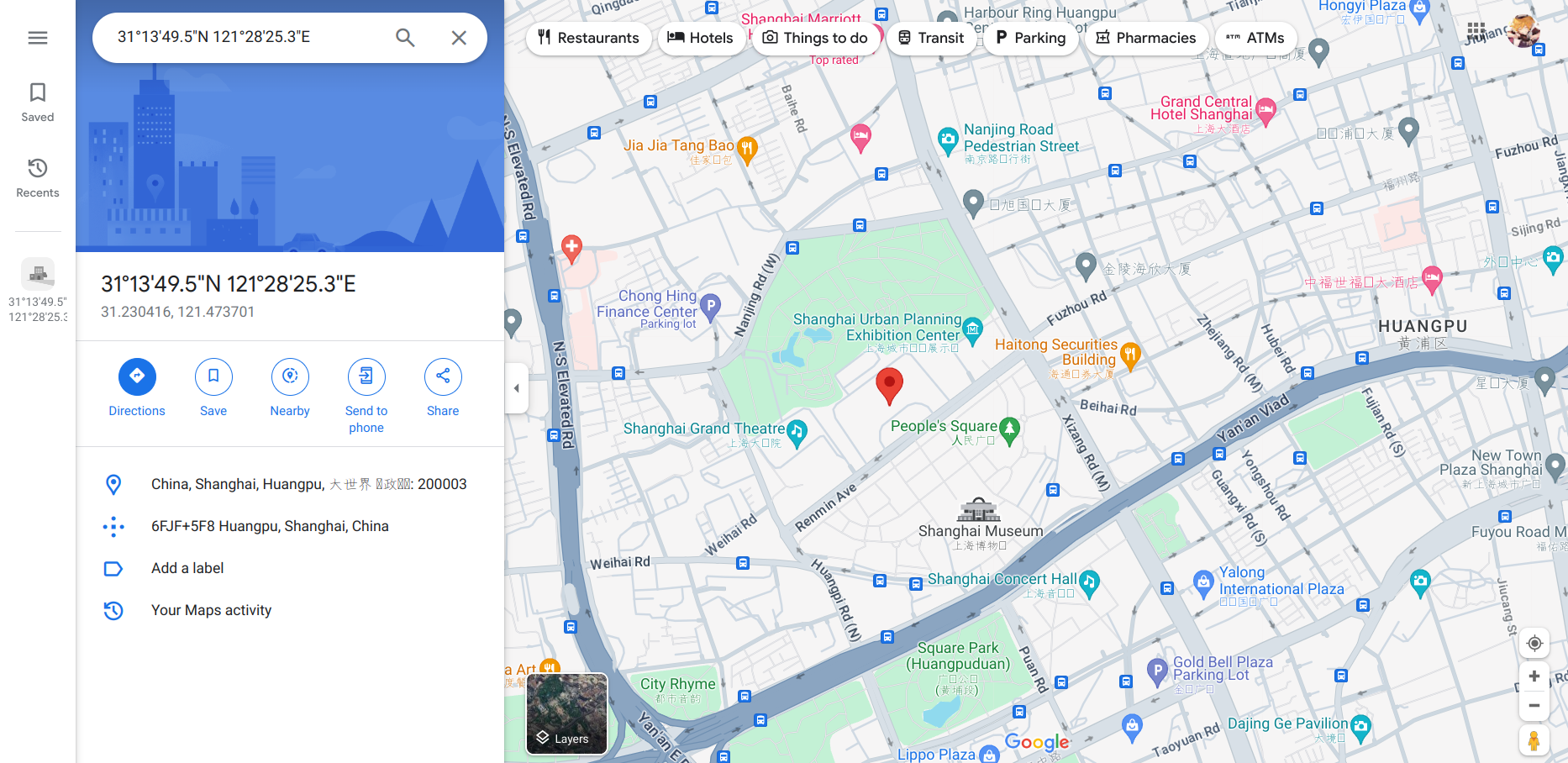
GeoSpy AI also gave this location, which is of course not accurate, but approximately we gotta look in Shanghai. (TLDR; Searching in Shanghai metro line was incorrect)
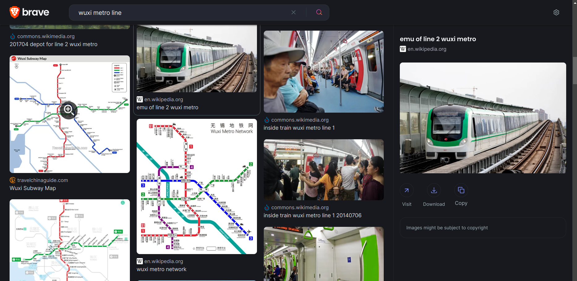
Switching my search from US to China, I searched for the metro lines and trains, specifically green stripe and 6 compartments long. There were a lot of trains but none of them matched. I went through alot of metro line maps, and train pictures but no lead.
At this step, my teammate @Cha0s was able to find the it, the wuxi metro line 2
Now we had to find the route, and check for highway which intersect with the metro’s path.
Luckily, most of the metro line is underground and only a few part of it is elevated out in the open. So, checking around this area
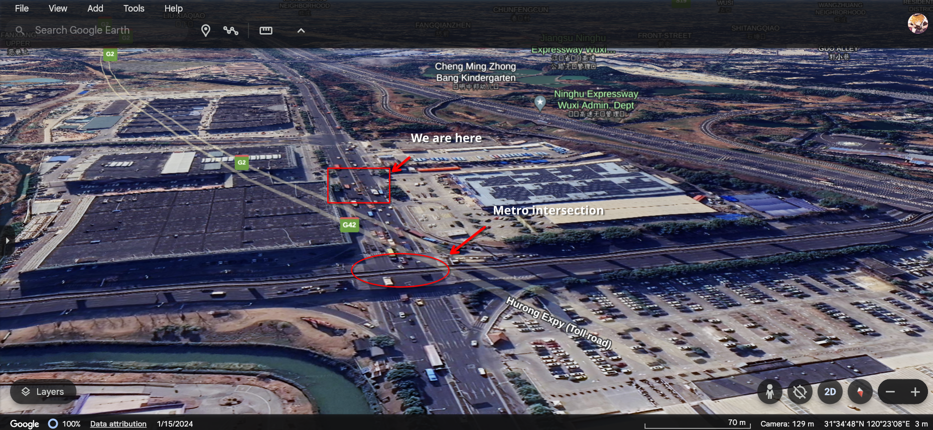
Looks like we found the location!
With a bit of trial and error, was able to guess to exact coordinates 31.579, 120.388
Thanks to @Cha0s and @ckc9759 for helping with this challenge.
Flag: uiuctf{31.579, 120.388}